
Genesee County Previous Residents by Era
There is no single file for previous residents of a Genesee County address. A good address history moves across sources that were made for different purposes. The current property card supplies a parcel starting point. A deed records a conveyance or other instrument. A directory or obituary can associate a person with a printed address. A tax assessment records administrative tax information. The distinction matters because an owner, a taxpayer, and a person printed at an address may be three different findings.
| Source | Years It Covers | Where Held | What It Shows |
|---|---|---|---|
| BS&A property search | Current display varies by municipality | BS&A Online Genesee County property search | Address, name, parcel-number, and assessment or tax context |
| Land documents | 1970-present digitized public documents | Genesee County Register of Deeds | Recorded conveyance or other instrument parties and dates |
| Older scanned land books | Older material, availability varies | Register of Deeds historical search route | Book or document images that may not have a name index |
| Flint directories | Late 1800s onward, by edition | Flint Public Library and Library of Michigan | Printed name, address, household notation, and occupation label |
| Tax assessments | 1844-1940, with later starts in 1960, 1970, and 1980 | Archives of Michigan guide and local custody routes | Administrative taxpayer or property-interest evidence |
Start with the source closest to the period in question. A recent Genesee County ownership question often begins with the parcel and recorded instrument. A pre-digital Genesee County address question may require FPL directories, Treasurer microfilm, maps, and the Archives guide. The county's records-management materials identify 1970 as a practical breakpoint: documents from 1970 forward are described as digitized and public, while older scanned documents may not be indexed.
Genesee County Previous Residents Start With Parcels
The BS&A Online Genesee County property search offers address, owner-name, and parcel-number routes. Begin with the situs address, then copy the municipality, street number, ZIP, parcel ID, and whether the displayed address is situs or mailing. Keep the assessment or tax year and the improvement labels with the search note. BS&A describes its results as reference information and directs corrections to the municipality, so a property card is a starting record rather than a final statement about who lived there.
Next compare the parcel through Genesee County FetchGIS. The county describes FetchGIS as a map layer for parcels, aerial imagery, address points, street centerlines, zoning, and other spatial data. Capture the selected parcel ID, situs address, municipality, and map context. The map supplies geometry, not title evidence. Its chief value in a Genesee County past-resident search is keeping a historic street reference tied to the correct parcel when a nearby number or municipal label could be confused.
| Address search | Starts with the situs location when the full street address is known. |
|---|---|
| Name search | Provides an owner-name route, which needs separate occupancy evidence. |
| Parcel number | Creates the strongest bridge between BS&A, FetchGIS, and the Register of Deeds. |
| Map context | Records the municipality, street geometry, and selected parcel before a historical comparison. |
Genesee County Previous Residents Deed Trail
The Genesee County Register of Deeds holds the land-record route. Use the parcel work to narrow the property, then record the grantor, grantee, recording date, instrument type, book or page information, and visible image details for each relevant document. The name-bearing instrument can establish a recorded event, but it does not by itself establish that a party occupied the address. Compare it with the directory, tax, or obituary evidence for the period.
- Search BS&A by the address, name, or parcel number and copy the parcel details exactly.
- Check FetchGIS to confirm that the parcel, municipality, and street geometry match the address under study.
- Use the Register of Deeds land-record route to locate a relevant recorded instrument and copy its party names, date, type, and image or book reference.
- For each earlier party, look for an earlier document that identifies the next property connection, then keep the evidence in date order.
- When the digital record is insufficient, use the historic image-book route, Treasurer material, or a precise request to the record custodian.
- Grantor
- A party shown as transferring or conveying an interest in a recorded instrument.
- Grantee
- A party shown as receiving an interest in a recorded instrument.
- Chain of title
- A dated sequence of recorded property instruments, not a directory of everyone who lived at the address.
- Legal description
- The parcel description used in a deed or land record. It may stay more stable than a historic street number.
Genesee County Past Residents Land Books
Older Genesee land research has a local trap: a scanned document may be present even when the name search does not find it. The county's historical index guidance describes one-book-per-document results and a document-image icon. Browse the returned historical book or image carefully, then record the book, page, image, and visible names. A no-result name search can therefore mean an indexing limit, not that the older record is absent.
The 1970 digitization threshold is a Genesee County method change, not a guarantee that every later item is perfectly indexed or every earlier item is missing. For pre-1970 work, combine the older image-book route with FPL maps and directories, Treasurer microfilm, and Archives series. For 1970-forward work, begin online and verify the underlying image. The county's 2024/25 records-system procurement described a planned transition, so live field labels, URLs, fees, and functions should be rechecked when a request is made.
Note: Record the source URL, access date, search terms, filters, and result count, so a later researcher can distinguish no result from not covered.
Genesee County Previous Residents House History
The FPL House History guide brings maps, directories, and local history into the address trail. It identifies Sanborn maps on film for Flint, Clio, Davison, Fenton, and Flushing, along with Genesee County plat maps, street maps from multiple years, Flint aerial photos from 1971, county histories, city directories, a Historic Homes Binder, and the Genesee County Biography File. Sanborn sheets can show lot outlines, building shape, construction material, and pasted changes, but coverage is not complete for every city area.
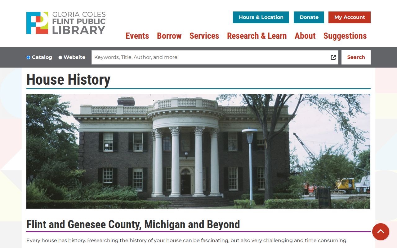
The House History capture shows why a Genesee County past-resident question needs more than a name index. A street map can supply location context, a directory can show a printed household association, and a deed can show a recorded transfer. Each row belongs in the address timeline with its source and date.
The Historic Homes Binder can contain a name, location, prior use, owners, construction date, architect, moved or razed status, photos, remodeling, disasters, or legends. It is a rich lead for the limited homes represented, not a complete county parcel file. Use it to form a precise follow-up question, then verify the relevant point through an original source.
Genesee County Past Residents in Directories
Property evidence answers only part of an address question. Flint directories can place a name at a printed address in a particular edition, while a census-year source can add household context. The Library of Michigan says Polk directories reach back to the late 1800s, and the National Archives listing identifies Flint directory microfilm for 1929-1932. Read the title page, geographic boundaries, abbreviation key, and street index before using an entry. The detailed shelves and how to read their entries are available in the Genesee County city directories collection.
Pairing Genesee County records works best as a small evidence flow: directory year and page, then matching census-year household context, then an independent end point such as an obituary, probate file, deed, tax assessment, or biography file. A name that disappears from a directory may reflect a move, a changed spelling, a coverage difference, or an unlisted person. It does not identify the reason by itself.
- Copy the directory's printed name, address, year, page, and any abbreviation.
- Check a nearby directory edition for a move, spelling difference, or changed household notation.
- Pair the relevant directory year with a verified census-year source and keep the sources separate.
- Use a deed, tax record, obituary, map, or probate series to test the most important conclusion.
Genesee County Past Residents Obituaries
The Flint Journal obituary indexes cover paid obituary indexes for 1920-1959 and from 2000 to the present. The index is a lead rather than the full notice. FPL offers microfilm assistance and an advance research request for approximately one hour at $25, due even when the search is unsuccessful. A directory, cemetery record, probate file, or deed should check any address conclusion drawn from newspaper material, since a notice may use a nickname or omit a residence detail.
The Genesee County Archives guide adds probate case-file series for 1857-1883, 1870-1875, and 1900-1973. It also identifies naturalization declarations, petitions, certificate stubs, and related series that can explain a Genesee County name variant or a move. Probate may connect heirs, executors, guardians, property, and a residence clue, but it is an archival series with its own record type and dates. Use the series title and date range in a request instead of asking the Archives to search broadly for a person.
Genesee County Past Residents Tax Records
The Archives guide lists tax assessments from 1844-1940 and later runs beginning in 1960, 1970, and 1980, plus township-specific assessment series. It also names delinquent-tax records from 1844-1877 and several early land-sale and tax-land series. These are useful for filling a gap before the current online property card, but an old tax assessment identifies an administrative taxpayer or property interest. It does not prove that the named party resided at the parcel.
The Treasurer's microfilm can help locate older Genesee County property-tax records. Research notes that original records may be held by the Treasurer or Perry Archives/Sloan Museum Buick Gallery, so confirm custody before making a trip or request. FPL's House History guide reports that recorder copies were historically available for $1 per copy, but current pricing must be verified with the Register of Deeds. Keep a tax item labeled as tax evidence and a map item labeled as geographic context.
Genesee County Previous Residents Evidence Labels
The strongest past-resident timeline says what each source proves. Label a directory line as a printed address association. Label a deed as a recorded conveyance or instrument event. Label an assessment as a tax or administrative association. Label a Sanborn, plat, aerial, or FetchGIS item as physical or geographic context. That vocabulary keeps a useful history from becoming an unsupported claim about who lived at a Genesee County address.
Lawful use. Use past-resident research for family history, local history, and personal property curiosity. Do not use public records to harass, track, or harm anyone.
For a well-supported Genesee County private research card, keep five dated rows: directory association, tax or assessment name, deed party, map or building description, and obituary, biography, or probate connection. Add the source URL, page or image reference, and a short statement of what the item proves. That format makes disagreement visible and avoids exposing unnecessary details about living people.