
Look Up Genesee County Neighbors
The public record trail around one Genesee County address is a set of layers. Start with a map because it fixes the focal parcel and the lots that touch it. Then open the matching property cards. The county map layer shows geometry and address context, while the property card shows administration data for a selected parcel. Local planning resources add a civic neighborhood name or group context, and library maps or directories can help place a block in an earlier period.
These records should not be used to infer every person at an address. The Michigan Voter Information Center provides public status and election information, not a block roster. A result in one source may establish a parcel, an owner or taxpayer field, a neighborhood context, or a historic printed association. It does not make all of those claims at once.
| Source | Block-level use | Access |
|---|---|---|
| Genesee County FetchGIS | Select a parcel, see surrounding geometry, street centerlines, address points, and map layers. | Online viewer. |
| BS&A property search | Check the matching address, owner-name, or parcel-number route and displayed assessment data. | Online property portal. |
| Flint Planning resources | Place an address within public neighborhood maps, plans, and group context. | City planning webpage and linked material. |
| FPL house-history resources | Use maps, directories, plats, or historic-home material for dated block context. | Library instructions and onsite sources. |
| Michigan Voter Information Center | Check public voting status and election information for an individual inquiry. | State online lookup, not a block directory. |
Note: Record the source date and the exact field used, because map context, parcel administration, and a printed address association are not interchangeable.
Genesee County Neighbor Parcel Cards
BS&A Online Genesee County property search provides address, owner-name, and parcel-number routes through its Detailed Record Search. Begin with the focal address, verify the municipality, street number, ZIP, parcel ID, and whether an address is situs or mailing, then compare adjoining parcel IDs one at a time. The parcel ID is the safest bridge between the BS&A card and FetchGIS. The portal asks users to direct errors to the municipality, which is the proper route when an assessment record appears wrong.
An owner or taxpayer name on the card is not proof that the person is one of the neighbors who lives there. That distinction is the key local myth to avoid. A deed records a conveyance or other instrument, a tax card describes assessment or tax administration, and a GIS parcel supplies spatial geometry. Use a dated directory, obituary, or similarly specific source if the question is about a historical person-address association.
| Official source trail | Commercial neighbor tools | Best practice |
|---|---|---|
| Shows the source type and fields the custodian publishes. | May combine material from different sources and dates. | Cross-check any name or address with the office that created the record. |
| Separates parcel geometry, assessment data, deeds, and civic context. | May blur ownership, mailing, and presence at an address. | State exactly what the cited record supports. |
| Offers a correction path through the responsible municipality or custodian. | May not show its correction source or update date. | Keep the result date and seek a custodian correction when needed. |
Map a Genesee County Neighbor Block
Genesee County FetchGIS is the map and spatial-neighbor layer. Its official flyer describes parcels, multiple years of aerial imagery, elevation contours, line and area measurement, point coordinates, graphic markup, and use on desktop, tablet, or mobile. The county identifies GIS as steward of parcel data, voting precincts and districts, aerial imagery, address points, street centerlines, elevation, and zoning. That makes it a strong first tool for the immediate block, but not the final authority for a deed or tax matter.
Use a deliberate parcel sequence. It keeps the nearby-lot work separate from claims about the people connected to those lots.
- Search the complete address in FetchGIS and select the parcel that matches the municipality and street number.
- Save the parcel ID, situs address, visible layers, and the geometry of adjoining parcels before moving outward.
- Open each adjoining parcel’s BS&A card by its parcel ID or address, retaining only the displayed property-administration context.
- Use a recorded document, historical directory, or municipal request only for the narrower fact it can support.
- For a full named-street record chain, use the Genesee County street directory rather than treating one block review as a streetwide result.
Premium FetchGIS products, such as parcel-detail information, custom maps, reports, notification lists with mailing labels, and shareable links, are described as transaction-based. If a premium product is used, preserve its name and transaction date in private research notes.
Genesee County Neighbor Address Details
Address precision matters when parcels sit close together or a search crosses a municipal edge. Michigan’s NG911 repository standardizes address points, street data, emergency-response zones, and dispatch mapping. The state GIS standard uses separate prefix, number, suffix, and composite-address fields. A street number without its direction or suffix can point to the wrong place, so preserve the form shown in the official source.
- Address point
- A mapped location used with street data and emergency-response mapping.
- Parcel ID
- The identifier that joins the property card to a mapped land unit.
- Situs address
- The property location address, which can differ from a mailing address shown in an assessment record.
- Composite address
- An address representation that preserves the parts needed to distinguish a nearby unit or suffix.
The Michigan NG911 repository explains the statewide mapping framework. For a Genesee County address, compare the full address with FetchGIS and the property card before deciding that two records refer to the same lot.
Flint Resources for Genesee County Neighbors
The City of Flint Planning Division links neighborhood groups, maps, plans, and zoning resources. Its material helps place a parcel in civic geography after the map establishes the correct lot. It does not establish that a named person belongs to a group or lives in a defined area. City map resources can change as groups ask Planning to add information, so note the publication date when using a map for context.
Flint’s neighborhood resources provide the source context for the captured planning page below.
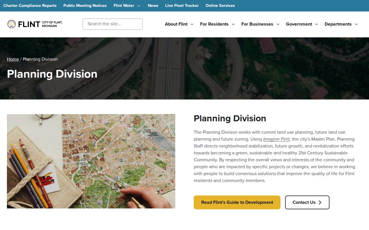
Use the Planning resource to identify public map and group links, then return to the parcel record for the address-specific work. The resource is civic context, not a list of the neighbors at a parcel.
Genesee County Neighbor Civic Groups
Flint’s public neighborhood map and Public Participation Plan identify a range of block clubs, historic areas, and civic groups. Those names are useful when an address has already been located on a parcel map. They can lead to public meetings, planning context, or boundary information. They do not create a complete membership or contact directory, and the City says its group list can be updated.
The Flint Public Participation Plan and Planning resources are the appropriate public source for these references. Use the listed organization only as a civic-context lead, then contact Planning through its public route when current participation information is needed.
| Publicly named Flint group or area | What the city material supports | Current-information route |
|---|---|---|
| Bel-Aire Woods | Neighborhood-map context. | City Planning resources. |
| Rollingwood Watch | Neighborhood-map context. | City Planning resources. |
| Civic Park Historic | Historic-neighborhood context. | City Planning resources. |
| Carriage Town Historic | Historic-neighborhood context. | City Planning resources. |
| Flint Neighborhoods United | Organization named in the participation plan. | City Planning resources. |
| Foss Avenue Block Club | Block-club name in the participation plan. | City Planning resources. |
Note: A group map can change and should be dated; it is not a permanent boundary authority or a membership record.
Read a Genesee County Neighbor Block
A current parcel map becomes more useful when paired with an older map or directory. The Flint Public Library House History guide identifies Sanborn maps, plat maps, city street maps, directories, 1971 Flint aerials, county histories, biography files, and a Historic Homes Binder. For Flint, Clio, Davison, Fenton, and Flushing, Sanborn material can connect a lot to a building footprint and use. It should not be treated as complete coverage for every location or year.
The local-history stack works best as a sequence: consult a street map for the route in a chosen year, use a Sanborn sheet or plat for physical context, review a directory for a printed address association, and keep each source’s edition or date. The library’s local-history collection also includes organization histories and city or village histories, which can explain a public civic connection without becoming proof of present-day presence.
When a block is especially complex, the library’s Local History & Genealogy Room supplies the onsite equipment and workflow for checking original material and microfilm.
Genesee County Neighbor Boundaries
Neighborhood, mailing, municipal, ZIP, and county boundaries do not always line up. Genesee County includes eleven cities, ten charter townships, seven civil townships, five villages, three census-designated places, and twenty unincorporated communities. The City of Flint map gallery and Planning resources can place a Flint address in a civic area, but county GIS and parcel records remain the better check for the parcel itself.
Fenton is a local boundary caution because official material identifies the city as partly in Oakland County. A Fenton address needs a parcel and county check. The same approach applies to edge ZIPs: a ZIP is a postal-routing answer, not proof of county jurisdiction, municipal limits, ownership, or presence at an address. Use the USPS ZIP Code Lookup for the mailing result and then confirm the parcel in FetchGIS.
Court Street Village offers one neighborhood-level example. Its public page places Central Park between Longway Boulevard, East Court Street, Gilkey Creek, and I-475, with meetings and a CSVNP contact route. That boundary is useful after parcel work; it is not evidence about any named person.
Genesee County Neighbor Privacy Limits
Public parcel and planning material has clear limits. Do not turn an owner field, map result, or civic-group reference into a claim about every person connected to an address. Michigan’s Address Confidentiality Program gives eligible participants a substitute address and free mail forwarding. The actual physical address collected by the program is confidential and must never be copied into a public directory. An absent address can be intentional and lawful.
Michigan FOIA is a request and inspection framework, not a guarantee that every record will be released. Protected addresses, juvenile and sealed court material, medical details, signatures, private emails, financial-account information, and identity-verification fields should be withheld or minimized. When a municipal record is not online, make a narrow request by parcel, street address, record type, and date range, and ask the custodian to separate releasable material from exempt portions.
Lawful personal use. Do not use neighborhood research for repeated contact, surveillance, intimidation, or any harmful purpose. Michigan law on stalking includes repeated harassment and unconsented contact at a residence or through communications.